
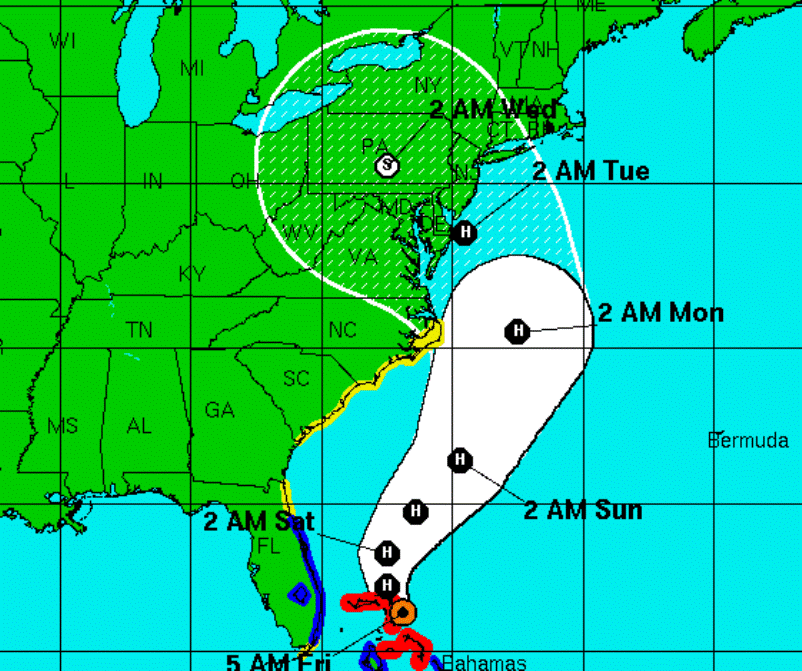
Latest Forecast Tracks Bring Sandy to Pennsylvania on Tuesday & Wednesday
The effects of Hurricane Sandy may reach Pennsylvania as early as Sunday, but according to the National Hurricane Center the storm itself is expected to come ashore near the New Jersey-Delaware border and then track directly over Pennsylvania late Tuesday and into Wednesday.
The main concern is that the tropical storm could collide with a westward-moving early winter system and park itself over the region for days, bringing heavy rains, winds and possibly snow in higher elevations. Officials are urging everyone in the path of Sandy to use their time wisely this weekend, preparing emergency kits with at least three days of drinking water and other necessities, as well as clearing storm drains and spouting, which may be clogged with fallen leaves.
A spokesperson for the Pennsylvania Emergency Management Agency says this potential “superstorm” could bring prolonged power outages that may last several days.